
Welcome to Yosemite National Park
Welcome to the Yosemite National Park Information Page.
Here you will find all you need to know about the natural history of the park.
Learn about the geology, trees, mammals, birds, or other plants and wildlife of the area.
where is yosemite national park
Yosemite National Park is located in eastcentral California, east of the city of Modesto, California.
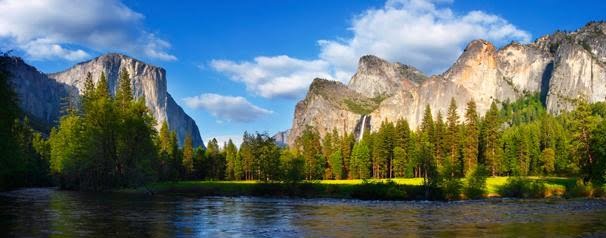
 Sentinel Bridge
Getting Here
The closest major airports are Oakland and San Francisco, California and there is a smaller airport in Modesto, California.
From the North
1. Take Highway 395 South to Stateroad 140 West to the park.
2. Take I-5 South or Stateroad 99 South to Stateroad 120 East or Stateroad 140 East to the park.
From the East
1. Take I-80 West to Highway 395 South to Stateroad 140 West to the park.
2. Take Highway 6 West to Highway 395 North to Stateroad 140 West to the park.
From the South
1. Take Highway 395 North to Stateroad 140 West to the park.
2. Take I-5 or Stateroad 99 North to Stateroad 140 East or Stateroad 120 East to the park.
From the West
1. Take Stateroad 120 East to the park.
2. Take Stateroad 140 East to the park.
Additional Directions and Information
There are four entrances to the park: the south entrance on Highway 41 north from Fresno, the Arch Rock entrance on Highway 140 West from Merced, the Big Oak Flat entrance on Highway 120 West from Modesto and Manteca and the Tioga Pass entrance on Highway 120 East from Lee Vining and Highway 395. The Tioga Pass entrance is closed from the first major snowstorm in November until approximately early June due to snow. The roads entering the park on its west side are kept open all year, but may require tire chains because of snow anytime between November and April.
Transportation
To the Park
You can access the park via state highways 120, 41 and 140.
Several airlines serve Fresno Yosemite International and United Express serves the Merced airport.
Motor coach transportation is available all year from Merced Amtrak station and Transportation Center to Yosemite Valley.
In the Park
You can travel in the park via personal vehicle, bicycle, tour bus. Free shuttle bus service in the eastern end of Yosemite Valley (year-round), between Wawona and the Mariposa Grove of Giant Sequoias and from Tuolumne Meadows to Tenaya Lake (summer only).
Establishment the Yosemite National Park
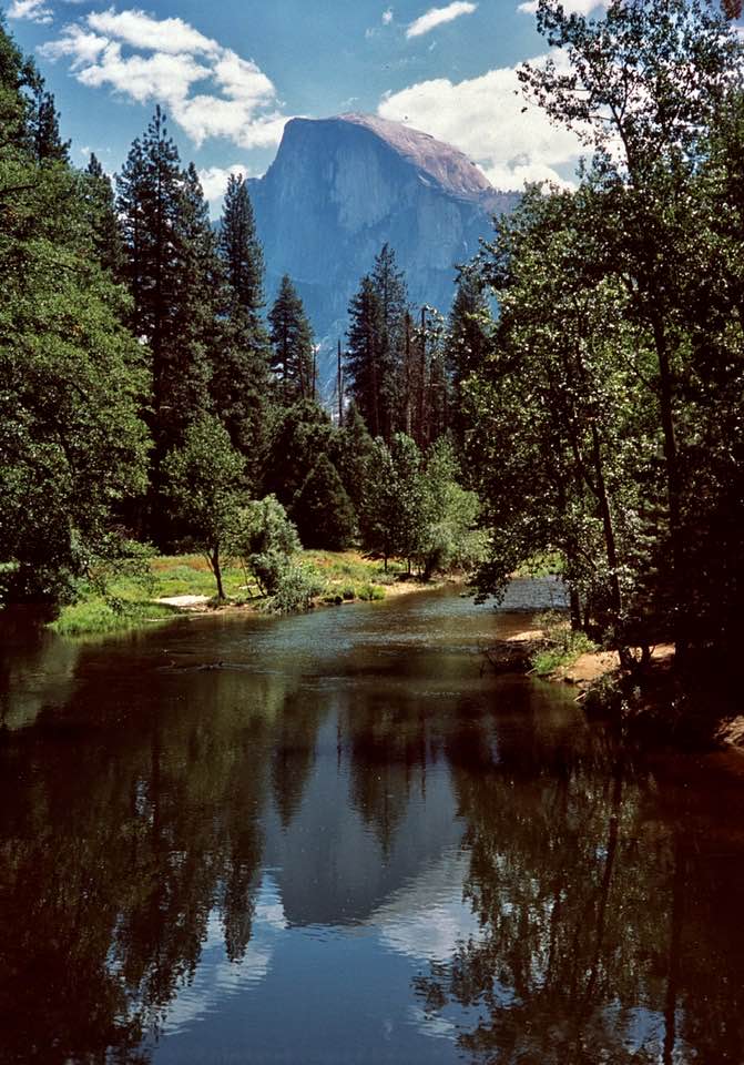
Yosemite National Park was established on 01 October 1890, and is the Nation’s third oldest national park. The park was established for the purpose of preservation of the resources that contribute to its uniqueness and attractiveness. Congress recognized the importance of preserving this great park for future public enjoyment when it established Yosemite National Park. Yosemite National Park is a showcase of spectacular geological features, including the greatest concentration of granite domes in the world and the largest exposed granite monolith in the world.
The first application of a park concept originated in Yosemite with the grant of 1864 (Federal land given to California for preservation) signed by Abraham Lincoln and since that time the park has played an important role in pioneering park management concepts.
Yosemite National Park possesses outstanding recreational values and supreme scenic attractions, including alpine and subalpine wilderness, three groves of giant sequoia trees and thundering waterfalls that are among the world’s highest. Yosemite was the birthplace of the idea of the Sierra Club and plays an important role in wildlife preservation and preserving biological diversity.
Yosemite National Park is a world heritage site which has made a significant contribution to California’s cultural heritage, to the national park movement, and to Yosemite’s 4,000 years of cultural heritage by Native Americans. The park provides solitude and inspiration and serves as an outdoor classroom for environmental education.
Size and Visitation of Yosemite National Park
Yosemite National Park embraces almost 1,200 square miles of scenic wild lands set aside in 1890 to preserve a portion of the central Sierra Nevada that stretches along California’s eastern flank. The park ranges from 2,000 feet above sea level to more than 13,000 feet and has these major attractions; alpine wilderness, three groves of Giant Sequoias and the glacially carved Yosemite Valley with impressive waterfalls, cliffs and unusual rock formations.
Size – as of 23 Sep 2000
Federal Land – 759,530.26 acres
Non-Federal Land – 1,736.02 acres
Gross Area Acres – 761,266.28
Yosemite National Park is open 24 hours a day, year round with the highest visitation in June, July and August and the lowest in December, January and February.
Visitation – 1999
Total Recreation Visits – 3,493,607
Accessibility
The park’s major sites can be viewed by automobile. Some trails and facilities are wheelchair accessible.
Basic Visit Recommendations
Stay for a minimum of four hours to tour Yosemite Valley. It would require at least two days to visit to all sites and areas in the park.
I recommend that you plan your trip and the areas you would like to see and then go and relax and make a day of it. Go and see all that is in the area and enjoy it. You spend more quality time and learn and see more than you could ever imagine.
Yosemite National Park embraces almost 1,200 square miles of scenic wild lands set aside in 1890 to preserve a portion of the central Sierra Nevada that stretches along California’s eastern flank. The park ranges from 2,000 feet above sea level to more than 13,000 feet and has these major attractions; alpine wilderness, three groves of Giant Sequoias and the glacially carved Yosemite Valley with impressive waterfalls, cliffs and unusual rock formations.
Best Time to Visit Yosemite National Park
Is there a “best” time of year to visit Yosemite? It depends what you’re looking for. Weather varies year by year, sometimes dramatically, and that affects the wateralls, wildflowers, and road openings.
Entrance Fees
Individual Entry (Bike, Foot) $ 10.00 (Seven Day Pass)
Private Non-commercial Vehicle $ 20.00 (Seven Day Pass)
Annual Pass (Good one year from date of purchase) $ 40.00
Gold Access Passport (Blind or permanently disabled) Free (Lifetime – good in all national parks)
Golden Age Passport (One time fee – for those 62+) $ 10.00 (Lifetime – good in all national parks)
National Park Pass (Good one year from purchase date) $ 50.00 (Good in all national parks)
Golden Eagle Pass (Good one year from purchase date) $ 15.00 (Good in all natl parks & natl forests)
Biking
There are nearly a dozen paved bikeways that wind through the eastern end of Yosemite Valley.
Birdwatching
Yosemite is home to variety of birds. The most commonly seen birds include the Stellar’s jay, American robin, Brewer’s blackbird, acorn woodpecker, raven, and black-headed grosbeak. In spring, listen for the splendid glissade of the red-wing blackbrid (most often seen in meadows) or watch the American dipper dart in and out of creek and river rapids.
Camping
Campgrounds in Yosemite are operated by the National Park Service. There are 13 campgrounds in Yosemite.
Fishing
Fishing regulations for Yosemite National Park follow those set by the State of California, including the requirement that a valid California sport fishing license must be displayed by all persons 16 years of age and older who are fishing in Yosemite National Park. Licenses must be plainly visible, attached to outer clothing at or above the waist line. To obtain licenses and additional information, inquire at concession facilities in Yosemite Valley and Wawona.
Yosemite’s streams and river fishing season is closed until the last Sat of April. The only exception is Frog Creek near Lake Eleanor where fishing season doesn’t open until 15 Jun in order to protect spawning rainbow trout. All lakes and reservoirs are open to fishing year round.
There are some special regulations that apply within the park:
No live or dead minnows or other bait fish, amphibians, non-preserved fish eggs, or roe may be used or possessed.
Fishing from bridges and docks is prohibited.
Food and Supplies
Food service and groceries are available in the park and in surrounding communities.
Pet Information
Pets must be kept on a leash. They are not allowed on trails, beaches, in the backcountry, or in public buildings. Campers with pets are restricted to Bridalveil Creek, Crane Flat, Hodgdon Meadow, Upper Pines, Wawona, White Wolf and Yosemite Creek campgrounds. A boarding kennel is available at the Yosemite Valley stables during the summer.
Swimming
Besides the outdoor pools available during summer at Curry Village, Yosemite Lodge, and Wawona Hotel, swimming is permitted in all bodies of water in the park except Hetch Hetchy Reservoir and above waterfalls.
Visitor Center
There are four visitor centers in Yosemite National Park. The Valley Visitor Center, located in Yosemite Valley is the largest and most comprehensive in terms of displays, books, postcards and maps. The Big Oak Flat Information Station, Wawona Information Station and Tuolumne Meadows Visitor Center are open on a more limited basis.
Weather of Yosemite National Park
Weather can change rapidly during all seasons of the year. Elevation plays a major role in temperature and precipitation. Most of the moisture comes in the months of January, February and March, and the winter climate is relatively mild. Sierra summers are typically warm and dry. April and November are transitional months, when warm, sunny days can suddenly become stormy. Clouds can build up during the summer to produce spectacular thunderstorm activity.
It is wise to pack for any season with clothing that can be “layered”, ready to peel off or add on as the thermometer dictates. Always include some kind of rain gear.